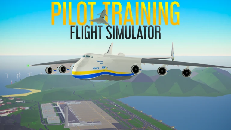
Mastering Pilot Training Flight Simulator Airport Charts
Learn how to use Pilot Training Flight Simulator airport charts effectively to improve your navigation skills, landing precision, and long-haul flight planning.
Published:
Table of Contents
Navigating the vast skies of Roblox's most popular aviation experience can be daunting without the right tools. Whether you are a novice aviator or a seasoned captain, understanding how to read and implement pilot training flight simulator airport charts is the secret to moving from basic flying to professional-grade navigation. These charts provide the essential blueprints you need to execute perfect approaches and taxi sequences every time you touch down.
Mastering these documents is vital because they reveal the hidden layouts of complex airfields, helping you avoid runway incursions and optimize your ground movement. In this guide, we dive deep into how to leverage pilot training flight simulator airport charts to enhance your gameplay, improve your ATC communications, and master challenging landings at airports like Sauthemptona.
Why Airport Charts Are Essential for Your PTFS Career
Many players jump into a Boeing 747 or an Airbus A380 and fly solely by sight, but this limits your growth as a pilot. Official navigation documents turn a casual flight into a structured simulation experience. By studying these layouts, you gain situational awareness that other players lack.
Using charts allows you to predict where your aircraft should be during every phase of flight. Instead of guessing your taxi path, you can follow established procedures, which is particularly helpful when interacting with the active ATC (Air Traffic Control) community.
Key Benefits of Chart Utilization
Feature
Benefit for Pilot
Runway Alignment
Reduces the risk of lining up with the wrong taxiway.
Spawner Locations
Saves time locating your aircraft spawn point.
Taxiway Logic
Prevents collisions with other players at busy hubs.
Fuel Station Map
Ensures you reach the refueling area efficiently.
Deciphering the Sauthemptona Airport Chart
Sauthemptona is a fantastic case study for understanding navigation. As the game’s only permanently snowy island, it presents unique atmospheric and geographical challenges. According to community reports, this airport features a single runway (08-26) and a relatively short landing strip compared to larger international hubs.
When you look at the chart for this specific location, you will notice a British Aiming Point design. This is a critical detail for your landing approach. Because the runway is shorter than those at larger airports, failing to touch down in the correct "box" can result in overrunning the end of the runway, leading to an awkward restart.
Landing Strategy at Sauthemptona
Approach Planning: Align your craft with the runway heading (08 or 26) well before crossing the threshold.
Speed Management: Given the shorter length, keep your approach speed strictly within the flap limits for your specific aircraft.
The Backtrack Rule: Remember that on runway 26, you will need to perform a controlled backtrack to reach the terminal, as the taxiway layout is limited.
Optimizing Your Taxi and Ground Operations
One of the most common mistakes beginners make in Pilot Training Flight Simulator is treating the ground like an open sandbox. While it is a game, professional pilots follow the taxi lines identified in the airport charts to keep the airbase flowing smoothly.
Study the Icons
Always look for the red dots on your charts, which typically represent universal plane spawners. The blue dots, often marked with an "H," indicate helicopter-specific spawn points. Planning your ground route before engine start saves fuel and prevents traffic jams.
Taxi System Complexity Comparison
Airport Type
System Complexity
Difficulty Level
Sauthemptona
Very Low
Beginner-Friendly
Saint Barthélemy
Low
Very Easy
Major Hubs
High
Advanced Planning Needed
Handling Long-Haul Flight Planning
If you are looking to push your skills to the limit, "long-haul" flights are your next milestone. Many experienced players use the isolation of airports like Sauthemptona to plan cross-map journeys to destinations like Izolirani, Orenji, or Perth.
When planning these flights, your "chart" isn't just about the runway; it’s about the distance and fuel consumption. Community players suggest that while heavy jets like the Boeing 747 can land at smaller fields, you must consider the fuel station location, which at many airports, is intentionally placed far from the main terminal.
Essential Pre-Flight Checklist
Weight Calculation: Ensure your fuel load matches your flight distance.
Chart Review: Identify your arrival airport’s runway configuration to plan your descent path early.
Taxiway Familiarization: Check if your chosen arrival airport requires a complex taxi route to reach the gates.
Overcoming Common Navigation Errors
Even with the best maps, players often fall into traps. The most frequent error is neglecting to check the "runway numbers" on the diagrams, which are often mirrored to match the real-world cardinal directions of the flight path.
Another common mistake is ignoring the "Change Log" or "Updates" tab on the official wiki. As developers update the game, terminal layouts or runway lengths can shift. Always ensure you are using the most current version of the navigation files found on the official Roblox game page.
Troubleshooting Your Flight Path
Problem: Landing too fast. Solution: Use the chart to identify your aiming point and reduce throttle 3nm before touchdown.
Problem: Getting stuck in a taxiway. Solution: Follow the designated lines on the chart rather than taking shortcuts across the grass.
Problem: Confusing spawners. Solution: Use the legend on the chart to differentiate between general aviation and heavy aircraft spawn points.
FAQ: Navigating the Skies
Q: Where can I find the most updated Pilot Training Flight Simulator airport charts?
A: The most reliable source is the official PTFS Wiki, which hosts detailed diagrams for every airport, including those with unique features like the snowy Sauthemptona runway.
Q: Do I really need to follow taxiway diagrams in a game?
A: While not mandatory, following the diagrams significantly increases your immersion and helps you avoid collisions with other players, which is essential if you participate in community ATC sessions.
Q: Are all airport runways the same length in the game?
A: No. Runways vary greatly in length, and charts are the only way to know if your aircraft can safely land on a specific strip. Always check the chart before attempting a landing with a large aircraft at a smaller airfield.
Q: Can I use these charts for formation flying?
A: Absolutely. Using charts during formation flying helps the group maintain a coordinated path through complex airport taxiways, ensuring all members of your squadron arrive at the departure point together.