Pilot Training Flight Simulator Map Guide: Airports & Routes
Master the Pilot Training Flight Simulator map with our guide. Explore airports, navigation charts, and flight routes in this massive Roblox flight sim.
Published:
Table of Contents
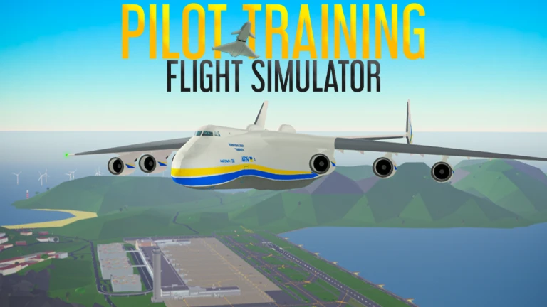
Navigating the vast open world of Pilot Training Flight Simulator (PTFS) on Roblox is both a rewarding challenge and a core part of the gameplay experience. Whether you are a novice pilot taking your first flight in a Cessna or a seasoned captain maneuvering a commercial jet, understanding the layout of the pilot training flight simulator map is essential for successful takeoffs and landings. The game, developed by the Pilot Training Club, offers a massive environment that mimics real-world geography, requiring players to develop strong situational awareness.
The sheer scale of the pilot training flight simulator map means that without a proper plan, it is easy to get lost over the ocean or overshoot your intended destination. This guide will provide you with the technical details, community-vetted tips, and navigational strategies needed to master the skies. From the bustling hubs of Greater Tokyo to the remote airstrips of the smaller islands, we will cover everything you need to know to navigate this virtual world with professional precision.
Quick Navigation Overview
The PTFS map is divided into several major regions, including Greater Tokyo, Perth, and Greater London. Utilizing the official Pilot Training Flight Simulator charts is the best way to ensure you are following correct flight paths and avoiding mid-air collisions.
Understanding the PTFS World Layout
The world within Pilot Training Flight Simulator is not just a single landmass but a collection of diverse islands and regions designed to test different piloting skills. The pilot training flight simulator map is engineered to provide a mix of high-altitude cruising and low-altitude precision flying. According to community reports, the map is structured to facilitate "island hopping," which allows players to experience different weather patterns and terrain types in a single session.
Each region is anchored by a primary international airport, surrounded by smaller regional airfields and specialized landing zones like aircraft carriers or heliports. This hierarchy of locations creates a realistic air traffic flow, where larger jets occupy high-altitude corridors between major hubs, while smaller aircraft populate the local airspace.
Major Geographical Regions
Understanding the geography is the first step in flight planning. The map is generally categorized into the following zones:
Greater Tokyo: A dense urban area with high-rise buildings and a massive international airport. It is the primary hub for commercial aviation roleplay.
Perth and Western Regions: Characterized by vast coastal areas and long approach paths, perfect for long-haul flight practice.
Greater London: A region that offers a mix of historical aesthetics and challenging airspace, often used for medium-range domestic flights.
The Islands (Hawaii/Small Atolls): These areas are ideal for general aviation and water-based landings for amphibious aircraft.
Key Locations and Airports on the Map
A pilot is only as good as their knowledge of the destination. The pilot training flight simulator map features a variety of airports, each with unique runway lengths, lighting systems, and approach difficulties. Choosing the right airport for your aircraft type is critical; attempting to land a Boeing 747 at a small dirt strip will almost certainly end in a crash.
Based on player experience, we have categorized the most frequently visited locations to help you plan your next sortie.
Primary International Hubs
Airport Name
Region
Runway Length
Difficulty
Best For
Tokyo International
Greater Tokyo
Long
Moderate
Commercial Airliners
Perth International
Western Zone
Long
Easy
Long-haul Training
London Heathrow
Greater London
Medium-Long
Hard
High-traffic Roleplay
Honolulu
Hawaii
Medium
Easy
Scenic Landings
Specialized Landing Zones
Beyond the standard runways, the pilot training flight simulator map includes specialized zones that require advanced handling. These locations are often used for military or emergency response roleplay.
Aircraft Carriers: Located in the open ocean, these require tailhook-equipped aircraft and precise speed control.
Mountain Airstrips: High-altitude locations where thin air affects engine performance and lift.
Water Docks: Specifically for seaplanes and amphibious vehicles like the Catalina or the Twin Otter.
Navigational Tools and External Resources
One of the most impressive aspects of the PTFS community is the development of external tools to assist in navigation. While the in-game UI provides basic coordinates, many players rely on the official "PTFS App" or community-maintained charts to stay on course. Using these tools effectively turns a simple flight into a professional simulation experience.
Using the PTFS Charts
The developers and community have created detailed charts that mimic real-world aeronautical maps. These charts provide information on:
Heading (HDG): The compass direction your aircraft is pointed.
Altitude (ALT): Your height above sea level, crucial for clearing mountain ranges.
ILS Frequencies: Instrument Landing System data for landing in low visibility (though simplified in Roblox).
Waypoints: Specific geographic markers used to define air corridors.
Mastering the Compass
Always cross-reference your in-game compass with the pilot training flight simulator map charts available on the official ptfs.app website. This prevents "drift" during long-distance flights across the ocean where landmarks are scarce.
Navigation Comparison Table
Tool Type
Accessibility
Accuracy
Recommended Use
In-Game Minimap
High (Default)
Low
Local area awareness
Official Web Charts
Medium (External)
High
Long-distance flight planning
Community Wiki Maps
High (Web)
High
Finding secret locations/Easter eggs
VFR (Visual Flight)
High (Skill-based)
Variable
Low-altitude scenic flying
Flight Planning and Popular Routes
Effective use of the pilot training flight simulator map involves more than just knowing where the airports are; it involves understanding the routes between them. Flight planning allows you to calculate fuel needs (if applicable in your roleplay) and estimated time of arrival (ETA).
Community Favorite Routes
Many players enjoy "Around the World" challenges, where they attempt to visit every major airport on the map in a single session. This requires careful management of speed and altitude.
The Urban Sprint: Tokyo International to London Heathrow. This route tests your ability to navigate between two high-density airspaces.
The Island Hopper: Starting from the mainland and visiting every small island airstrip using a light prop plane.
The Coast-to-Coast: Flying from the furthest Western point to the furthest Eastern point, often used for testing the endurance of new aircraft additions.
Route Planning Steps
Step
Action
Why it Matters
1
Select Aircraft
Determines which runways you can safely use.
2
Check Weather
High winds or fog can make certain map regions dangerous.
3
Plot Waypoints
Ensures you don't fly into restricted airspace or mountains.
4
Set Cruise Altitude
Optimizes speed and keeps you above local traffic.
5
Verify Arrival ATIS
Knowing the active runway prevents head-on collisions.
Advanced Tips for Exploring the Map
For those who have spent hundreds of hours in the game, the pilot training flight simulator map still holds secrets. Exploring the fringes of the map can lead to discovering hidden landmarks or unique terrain features that aren't highlighted on the main UI.
Discovering Hidden Areas
Community reports suggest that the edges of the map contain "Easter eggs" placed by the Pilot Training Club developers. These might include small, unmarked islands or unique geological formations. When exploring these areas, it is recommended to use a high-endurance aircraft like the Global 6000 or a military scout plane.
Low-Level Recon: Fly at sub-500 feet altitudes to spot small details that are invisible from the flight levels.
Night Exploration: Some locations on the map have unique lighting patterns that are only visible after sundown in the game's day/night cycle.
Community Challenges: Join Discord-based flight clubs that organize group explorations of the map's furthest reaches.
Common Navigation Mistakes
Even veteran pilots make mistakes when interacting with the map. Avoiding these common pitfalls will improve your reliability as a pilot in the community.
Ignoring the Altimeter: In mountainous regions of the map, many pilots crash because they rely on visual distance rather than their instruments.
Wrong Runway Approach: Landing at a small airport with a heavy jet often results in overshooting the runway into the sea.
Lost at Sea: Flying without a heading toward the islands can lead to running out of fuel (or patience) before finding land.
Airspace Congestion
The Greater Tokyo area on the pilot training flight simulator map is often extremely crowded. Always check your surroundings and use the chat or specialized ATC tools to announce your intentions to avoid mid-air collisions.
The Evolution of the PTFS Environment
The map we see today is the result of years of updates. The Pilot Training Club frequently expands the world, adding new islands, refining textures, and improving the layout of existing airports. This evolution keeps the game fresh for long-time players.
Whenever a new update drops, the community quickly updates the interactive maps. Staying connected with the community via the official Roblox group or the Fandom wiki ensures you are always flying with the most current information. The transition from a simple flat plane to a complex, multi-region world has solidified PTFS as the premier flight simulator on the Roblox platform.
Frequently Asked Questions
How do I access the full pilot training flight simulator map?
The full map is available to all players by default. To see a detailed version with waypoints and airport codes, it is highly recommended to use the official PTFS charts found on their external web tools or the community-run wiki. These resources provide a much higher level of detail than the basic in-game UI.
What is the largest airport on the map?
Tokyo International is widely considered the largest and most complex airport on the pilot training flight simulator map. It features multiple long runways, extensive taxiway networks, and a large terminal area, making it the preferred choice for players flying large commercial aircraft like the Airbus A380 or Boeing 747.
Are there any secret locations on the PTFS map?
Yes, the map contains several "Easter eggs" and unmarked landing strips. Players often share coordinates for these locations in community forums. Some are located on the very edges of the rendered world, requiring a long flight over open water to reach.
How do I navigate between islands without getting lost?
The best way to navigate is by using a compass heading. By referencing the pilot training flight simulator map, you can determine the exact degree (e.g., 270 degrees for West) you need to fly to reach your destination. Keep a constant altitude and watch for landmasses on the horizon. Using the "PTFS App" for real-time tracking is also a popular method among advanced players.